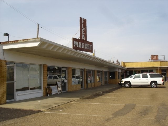
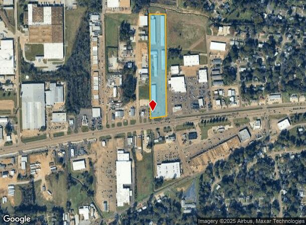
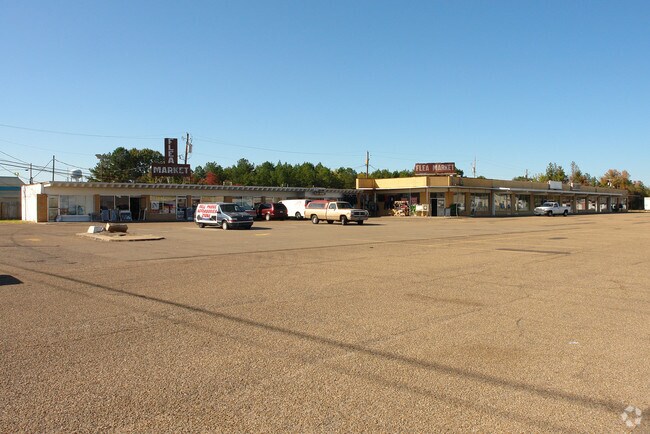
Property Record
3064 Highway 80 E, Pearl, MS 39208
NEARBY LISTINGS FOR SALE OR LEASE
Property Detail
3064 Highway 80 E
E09C-000021-00000
6.5A IN E2 E2 SE4 SW4 SEC 8 & PART OF E2 E2 NE4 NW4 SEC 17 N/S HWY 80 DB 291 PG 133 0102572 DB 465 PG 0490 0011883 DB 509 PG
Stripcommercialcenter
Rankin
A
Mississippi
28121C0186G
6.50 AC
2024
Brandon/Flowood/Pearl
2024
Jackson
020301
Jackson, MS
15,244 SF
DEMOGRAPHICS near 3064 Highway 80 E
1 Mile
3 Mile
5 Mile
2024 Total Population
5,332
21,139
55,493
2029 Population
5,419
21,624
55,509
Pop Growth 2024-2029
+ 1.63%
+ 2.29%
+ 0.03%
Average Age
39
39
39
2024 Total Households
2,083
8,021
22,147
HH Growth 2024-2029
+ 1.68%
+ 2.41%
(0.32%)
Median Household Inc
$48,616
$49,217
$49,223
Avg Household Size
2.50
2.40
2.20
2024 Avg HH Vehicles
2.00
2.00
2.00
Median Home Value
$139,062
$135,490
$160,649
Median Year Built
1969
1976
1977
Nearby Places
Map Layers
Map Styles
 Street
 Aerial
- Restaurants
- Banks
- Shops
- Fitness
- Groceries
PUBLIC TRANSPORTATION
COMMUTER RAIL
Jackson (City of New Orleans - Amtrak)
DRIVE
WALK
Distance
Jackson (City of New Orleans - Amtrak)
10 min
6.0 mi
AIRPORT
Jackson-Medgar Wiley Evers International
DRIVE
WALK
Distance
Jackson-Medgar Wiley Evers International
11 min
4.8 mi
Freight Ports
Port of Greater Baton Rouge
DRIVE
WALK
Distance
Port of Greater Baton Rouge
200 min
179.1 mi
Nearby Properties
Address
Land Use
TOTAL SIZE
Lot Size
Zoning
Address
Land Use
TOTAL SIZE
Lot Size
Zoning
40,148 SF
37.47 AC
Address
Land Use
TOTAL SIZE
Lot Size
Zoning
373.20 AC
Address
Land Use
TOTAL SIZE
Lot Size
Zoning
58.94 AC
Address
Land Use
TOTAL SIZE
Lot Size
Zoning
123,308 SF
20.88 AC
Address
Land Use
TOTAL SIZE
Lot Size
Zoning
249,342 SF
29.79 AC
Address
Land Use
TOTAL SIZE
Lot Size
Zoning
30,925 SF
38.73 AC
Address
Land Use
TOTAL SIZE
Lot Size
Zoning
4,008 SF
8.30 AC
Address
Land Use
TOTAL SIZE
Lot Size
Zoning
40.72 AC
Address
Land Use
TOTAL SIZE
Lot Size
Zoning
5,354 SF
0.68 AC
Address
Land Use
TOTAL SIZE
Lot Size
Zoning
30,800 SF
5.66 AC
Address
Land Use
TOTAL SIZE
Lot Size
Zoning
2,348 SF
16.45 AC
Address
Land Use
TOTAL SIZE
Lot Size
Zoning
1,257 SF
2.65 AC
Address
Land Use
TOTAL SIZE
Lot Size
Zoning
90,610 SF
Address
Land Use
TOTAL SIZE
Lot Size
Zoning
31,427 SF
40.65 AC
Address
Land Use
TOTAL SIZE
Lot Size
Zoning
139,417 SF
13.50 AC
Address
Land Use
TOTAL SIZE
Lot Size
Zoning
9,632 SF
32.54 AC
Address
Land Use
TOTAL SIZE
Lot Size
Zoning
48,048 SF
5 AC
Address
Land Use
TOTAL SIZE
Lot Size
Zoning
10,086 SF
2.41 AC
Address
Land Use
TOTAL SIZE
Lot Size
Zoning
253,479 SF
17.08 AC
Address
Land Use
TOTAL SIZE
Lot Size
Zoning
65,915 SF
5.71 AC
Address
Land Use
TOTAL SIZE
Lot Size
Zoning
67,442 SF
2.85 AC
Address
Land Use
TOTAL SIZE
Lot Size
Zoning
70,433 SF
2.53 AC
Address
Land Use
TOTAL SIZE
Lot Size
Zoning
6,538 SF
35.76 AC
Address
Land Use
TOTAL SIZE
Lot Size
Zoning
87,907 SF
14.71 AC
Address
Land Use
TOTAL SIZE
Lot Size
Zoning
33.64 AC
Address
Land Use
TOTAL SIZE
Lot Size
Zoning
5.06 AC
Address
Land Use
TOTAL SIZE
Lot Size
Zoning
71,705 SF
11.52 AC
Address
Land Use
TOTAL SIZE
Lot Size
Zoning
58,208 SF
2.41 AC
Address
Land Use
TOTAL SIZE
Lot Size
Zoning
57,272 SF
3.86 AC
Address
Land Use
TOTAL SIZE
Lot Size
Zoning
245,515 SF
9.73 AC
The World's #1 Commercial Real Estate Marketplace
Connect with us
© 2026 CoStar Group
The information above has been obtained from sources believed reliable. While we do not doubt its accuracy we have not verified it and make no guarantee, warranty or representation about it. It is your responsibility to independently confirm its accuracy and completeness. Any projections, opinions, assumptions, or estimates used are for example only and do not represent the current or future performance of the property. The value of this transaction to you depends on tax and other factors which should be evaluated by your tax, financial, and legal advisors. You and your advisors should conduct a careful, independent investigation of the property to determine to your satisfaction the suitability of the property for your needs.